Essex · Story 3 of 3
Ambresbury Banks: an Iron Age enclosure in Epping Forest
Banks, a ditch and pieces of pottery leave clues about an old enclosure, and plenty of questions about the people who used it.
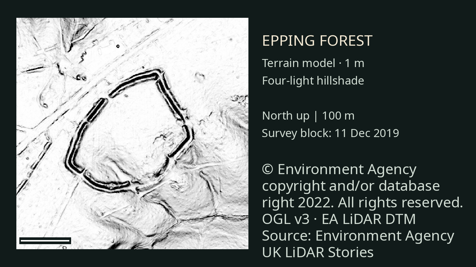
An enclosure among the trees
In Epping Forest, a bank and ditch surround an area of roughly five hectares. The place is known as Ambresbury Banks. Pottery found in the ditch suggests that the enclosure was used in the second half of the first millennium BC, with later use, or perhaps reuse, before the Roman conquest. [1]
Historic England identifies the original entrance as being in the north-west and describes a stone-lined passage with inner and outer gates. A Prehistoric Society guide instead identifies the south-west gap as the original entrance. The accounts do not agree, so its position needs further checking. The published excavation report describes the north-west gateway. [1] [6] [7]
The people behind the banks
We do not know who used Ambresbury Banks or whether anyone lived inside it. Across Iron Age Britain, many people lived in small farming communities, growing crops, keeping animals and using iron tools. [1] [2]
Hillforts could serve different purposes. Historic England describes sites elsewhere with evidence of intensive occupation, while others lack firm settlement evidence. Storage, exchange and communal or religious activity are among the possible uses of hillforts, but the purpose of Ambresbury Banks remains uncertain. [3]
Only a small part of the interior has been excavated. Pottery helps date the site’s use, while the earthworks show where people shaped and enclosed the ground. [1]
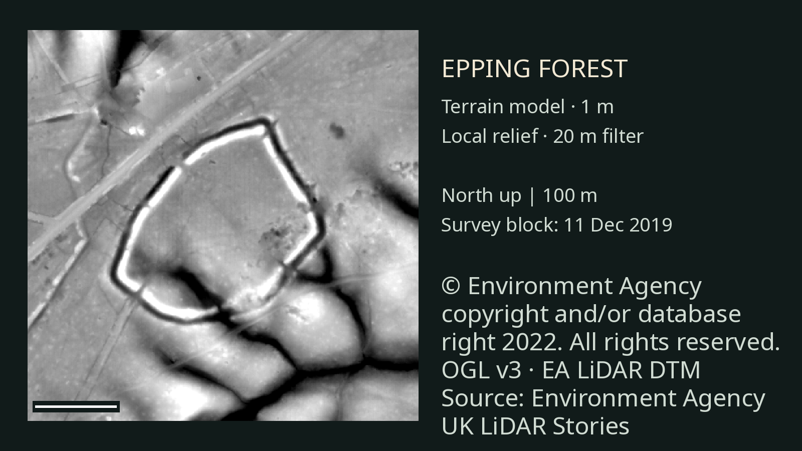
Looking through the forest
The views on this page use an Environment Agency digital terrain model. LiDAR processing estimates the shape of the ground from a laser survey, reducing the effect of surface objects. The second image displays the same terrain data differently, bringing out smaller changes in height. [4]
A separate Historic England project surveyed Epping Forest and surrounding land using commissioned 0.25 metre LiDAR and aerial photographs. Our images use a different Environment Agency dataset at 1 metre resolution, so the finer features in the report should not automatically be assumed visible here. Nor have we independently matched every shape in our images to a named archaeological feature. [5]
The survey gives archaeologists a view of the forest landscape around the enclosure. [5]
Sources and further reading
- Historic England: Ambresbury Banks list entry Earthworks, excavation and dating evidence. Historic England may restrict access in some browsing environments.
- British Museum: Prehistoric Britain General background on Iron Age communities.
- Historic England: Settlement Sites to 1500 Different interpretations of hillforts. Historic England may restrict access in some browsing environments.
- Environment Agency: National LiDAR Programme Source terrain data and licensing.
- Historic England: Epping Forest Uncovered The separate forest survey and its source data. Historic England may restrict access in some browsing environments.
- The Prehistoric Society: Ambresbury Banks and Loughton Camp An alternative interpretation of the original entrance.
- Essex Archaeology and History: excavations at Ambresbury Banks The 1978 excavation report, from page 189.
Terrain images use the Environment Agency’s National LiDAR Programme. The survey date describes the survey block, not a separately confirmed flight time over the site.