Suffolk · Story 1 of 3
Sutton Hoo: the people behind the ship burial
A burial chamber, a vanished ship and the objects that suggest a life of wealth and status in seventh-century East Anglia.
A ship beneath a mound
About 1,400 years ago, people placed a ship in the ground at Sutton Hoo. In a chamber amidships they laid a dead person with weapons, armour, gold, silver vessels and drinking horns. A mound was raised over the burial. The ship was about 27 metres long, but by the time it was excavated its timbers had decayed, leaving an impression in the sand. [1] [2]
The burial was discovered in 1939. Local archaeologist Basil Brown and his team began uncovering the ship; Charles Phillips later led the excavation of the burial chamber. The famous helmet came out in fragments among a much larger collection of objects. [2] [3]
Who was buried here?
We do not know their name. No body survived, although analysis of the soil suggests a body had been laid in the chamber and decayed in the acidic ground. One possibility is an East Anglian ruler, but several candidates have been proposed and none can be identified with certainty. [1]
The things placed in the chamber point to someone of exceptional status. Weapons and armour sit alongside objects associated with drinking and feasting. The British Museum suggests that the objects may have been intended for an afterlife. [1]
Reading the ground
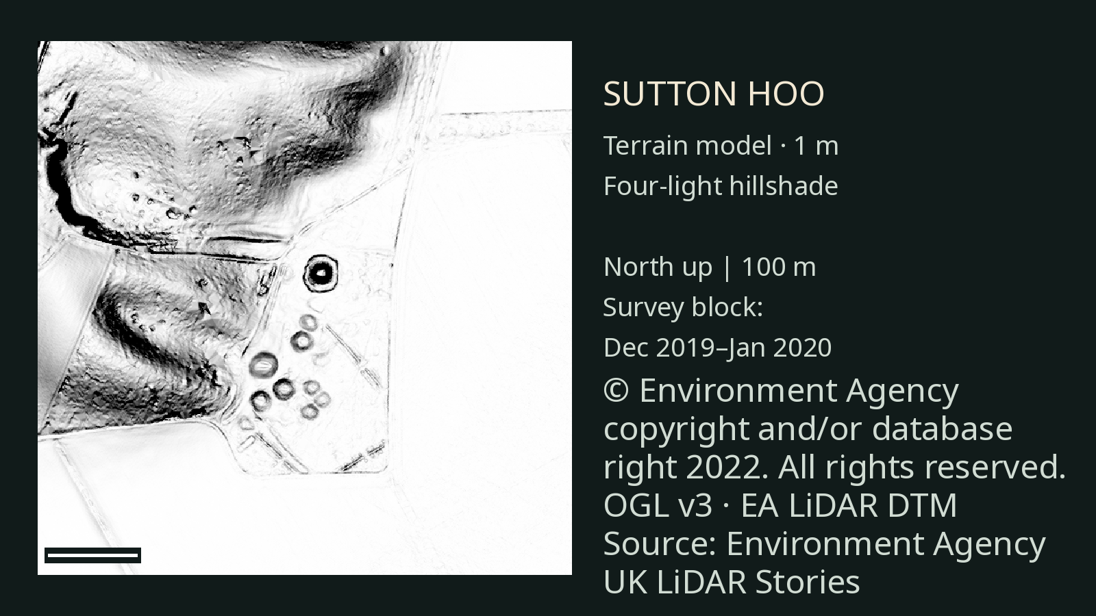
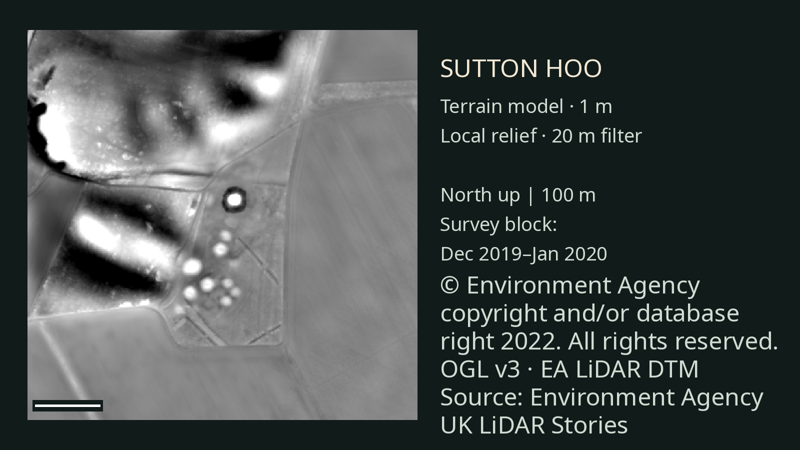
The images here use Environment Agency LiDAR data processed into a digital terrain model. The first gives the landscape a shaded appearance; the second emphasises smaller changes in height. Both come from the same underlying survey, so they are two views of one dataset, not separate discoveries. [4]
Sutton Hoo was already known and investigated long before this survey. The National Trust describes around 18 burial mounds at the Royal Burial Ground, although erosion makes the original number uncertain. One mound was reconstructed in 1992 as an experiment in erosion. The ground visible today therefore reflects later changes as well as its earlier history. We have not independently matched individual shapes in these images to named mounds. [2] [3]
LiDAR can help us examine the shape of the landscape. It cannot see the ship or its contents beneath the ground, identify the person buried, or date the burial. Those conclusions come from excavation, the objects and historical interpretation. [1] [2] [4]
Sources and further reading
- British Museum: Anglo-Saxons, Sutton Hoo Burial contents, identity and interpretation.
- National Trust: the Royal Burial Ground Ship, mounds and later reconstruction.
- National Trust: history of archaeology at Sutton Hoo The excavation and the people involved.
- Environment Agency: National LiDAR Programme Source terrain data and licensing.
Terrain images use the Environment Agency’s National LiDAR Programme. The survey date describes the survey block, not a separately confirmed flight time over the site.